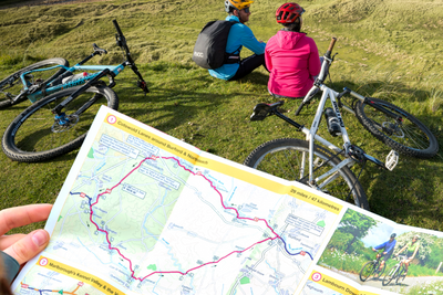
Kennet & Avon Canal and River Avon map
Tourist map of the Kennet & Avon Canal and River Avon at 1:50,000, with detailed town plans at 1:12,500.
This map marks National Cycle Network Route 4 between Bristol and Reading and small parts of other intersecting National Cycle Routes. Includes navigation and historical information, visitor moorings, marinas and boatyards, boat hire centres, facilities for the boat user, shops and distance markers. Other information included: tourist information centres, places of interest, pubs, public toilets and caravan and camp sites.
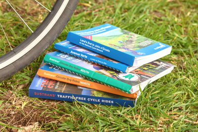
Shop all Sustrans maps and guides here.
Author: Heron Maps
Published: 2013
Scale: 1:50,000 and 1:12,500
How long does Standard Delivery take?
Standard Delivery can take between 2-5 working days. For more information please visit our Shipping page
Where is my order?
If your order has not arrived please do drop us an email at customer.services@sustrans.org.uk so that we can look into this for you.
Why is my discount code not working?
Discount codes are case sensitive, please double check the entry of it.
Some discount codes have restrictions, such as SHOP15, so please read the terms and conditions. If you are still having issues please contact us on customer.services@sustrans.org.uk
My gift card isn't being recognised?
Please email the customer service team or use the contact us tab below and we will look into it for you.
Why don't we sell to the US?
Due to the recent suspension of the de minimis exemption, we’ve made the decision to temporarily pause all sales to the US. This change impacts how goods are imported and processed, making it challenging to continue offering our usual service to US customers.
We’re actively monitoring the situation and exploring solutions. Once we’re confident we can resume shipping reliably and cost-effectively, we’ll reopen US sales and notify our customers. Thank you for your patience and understanding.
Shipping
Orders received by 12pm will be dispatched on the same day Monday to Friday.
Orders placed over the weekend will be shipped Monday, excluding bank holidays.
Pricing
Free delivery for all UK orders over £100
Standard delivery £3.95 for orders up to 2kg
Standard delivery £5.50 for orders over 2kg
Next day delivery (RoyalMail Tracked 24) £11
Rest of the world
Delivery charges vary according to weight.
We are currently unable to ship to the United States and US outlying islands, Norway, Switzerland, Lichtenstein and Iceland.
Why don't we sell to the US?
Due to the recent suspension of the de minimis exemption, we’ve made the decision to temporarily pause all sales to the US. This change impacts how goods are imported and processed, making it challenging to continue offering our usual service to US customers.
We’re actively monitoring the situation and exploring solutions. Once we’re confident we can resume shipping reliably and cost-effectively, we’ll reopen US sales and notify our customers. Thank you for your patience and understanding.