Wales Regional Map Collection
Explore Wales by bike and save 15% with this Sustrans pocket map bundle*
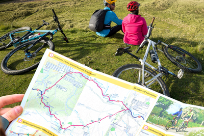
These pocket-sized colour maps show clearly mapped on-road and traffic-free paths, easy-to-read contours, and detailed inset maps for the major towns and cities as well as recommended linking routes connecting the National Cycle Network with quiet roads.
All maps are printed on water resistant and tear resistance paper, perfect for cycling adventures.
The National Cycle Network and cycle tracks in Wales
The Wales map collection will help you plan cycle routes and explore Wales by bike, showing the best of the National Cycle Network across the country.
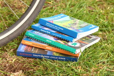
The Wales bundle includes all 5 Wales maps:
*No other discounts can be applied to this offer
Individual map details:
Publisher: Sustrans
Scale: 1:110,000
Size: 10 x 15 cm folded, 60 x 80 cm unfolded
Printed on water and tear-resistant Polyart recyclable paper, category 2 HDPE.
Shipping
Orders received by 12pm will be dispatched on the same day Monday to Friday.
Orders placed over the weekend will be shipped Monday, excluding bank holidays.
Pricing
Free delivery for all UK orders over £100
Standard delivery £3.95 for orders up to 2kg
Standard delivery £5.50 for orders over 2kg
Next day delivery (RoyalMail Tracked 24) £11
Rest of the world
Delivery charges vary according to weight.
We are currently unable to ship to the United States and US outlying islands, Norway, Switzerland, Lichtenstein and Iceland.
Why don't we sell to the US?
Due to the recent suspension of the de minimis exemption, we’ve made the decision to temporarily pause all sales to the US. This change impacts how goods are imported and processed, making it challenging to continue offering our usual service to US customers.
We’re actively monitoring the situation and exploring solutions. Once we’re confident we can resume shipping reliably and cost-effectively, we’ll reopen US sales and notify our customers. Thank you for your patience and understanding.