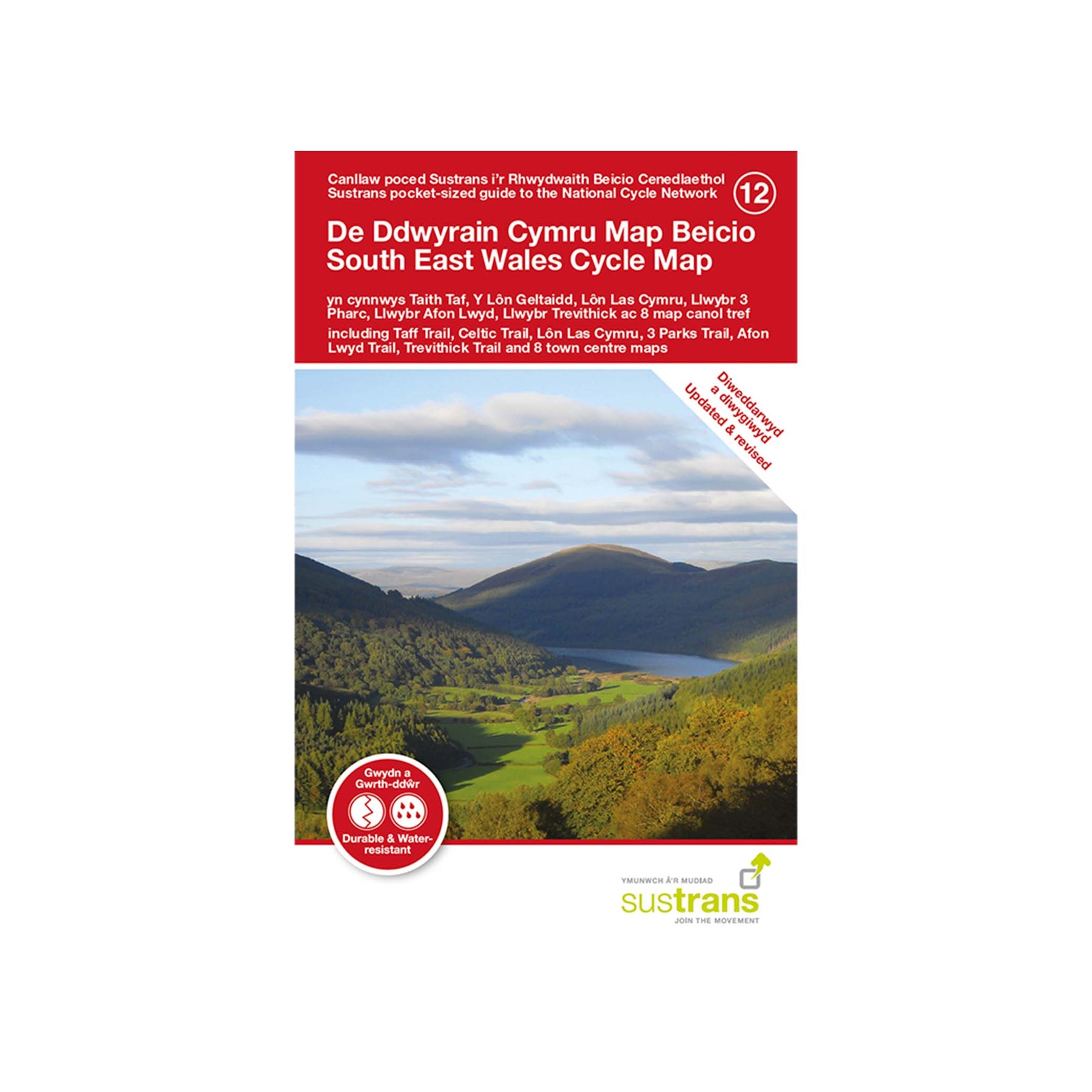
South East Wales Cycle Map (12)
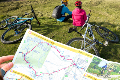
The South East Wales cycle map shows the National Cycle Network and local routes in this area. It covers the South East of Wales, including Cardiff, Newport, The Valleys, and Brecon.
About the South East Wales cycle map
The South Wales Valleys were at the heart of the Industrial Revolution, and now many of the railways, tram roads and towpaths that carried raw materials have been transformed into beautiful walking and cycling routes. If you want action-packed cycling adventures combined with panoramic views, wildlife-rich country parks and fascinating heritage sites, then the South East of Wales is the place to explore.
This map covers sections of South Wales' most popular cycle routes, including:
- Taff Trail
- Celtic Trail
- Lon Las Cymru
- 3 Parks Trail
- Afon Lwyd Trail
- Trevithick Trail.
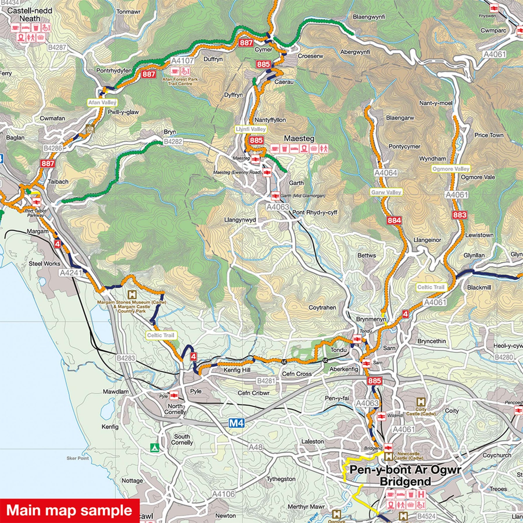
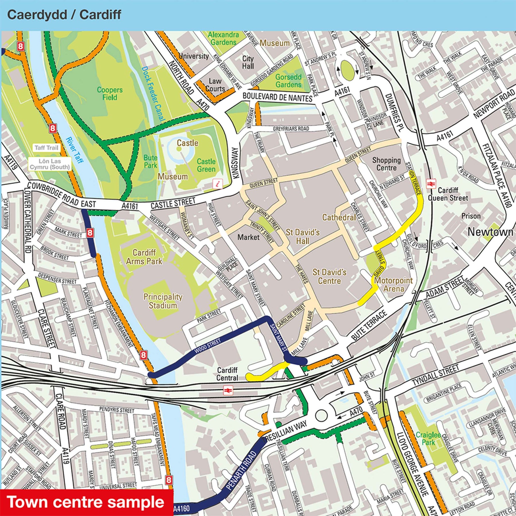
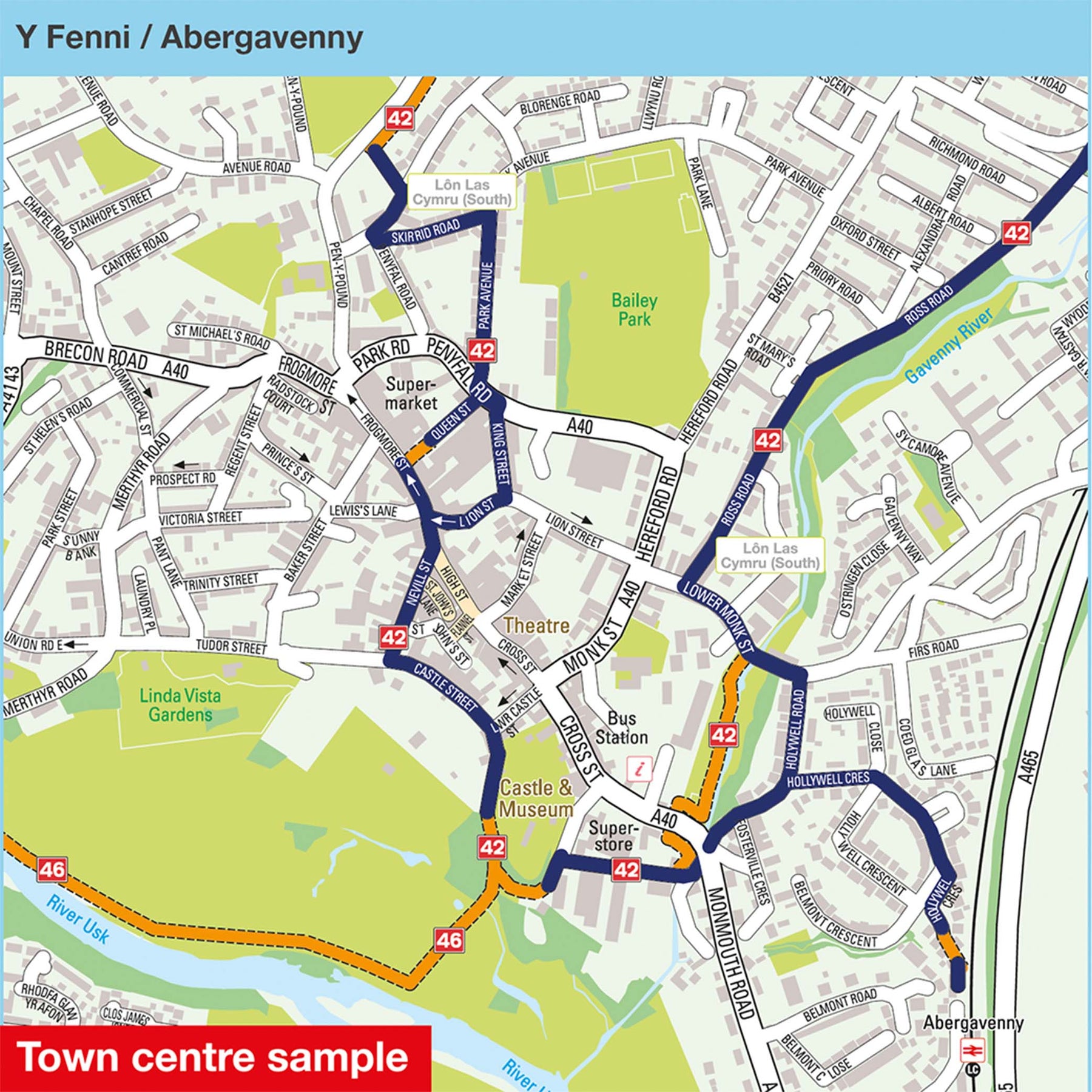
This pocket-sized colour map shows clearly mapped on-road and traffic-free paths, easy-to-read contours, and detailed inset maps for the major towns and cities as well as recommended linking routes connecting the NCN with quiet roads.
We also offer a cycle map covering South West Wales.
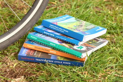
Shop our full range of regional cycle maps here.
Map details:
Publisher: Sustrans
ISBN: 9781914410031
Published: June 2021
Scale: 1:110,000
Size: 10 x 15 cm folded, 60 x 80 cm unfolded
Printed on water and tear-resistant Polyart recyclable paper, category 2 HDPE.
Major cycle routes covered by this map:
National Route 4 from Severn Bridge, Chepstow, Newport, Caerphilly and over to Port Talbot (Celtic Trail)
National Route 8 from Cardiff, north through Pontypridd and Merthyr Tydfil, around the base of Pen Y Fan and up to Brecon (Taff Trail & Lon Las Cymru)
National Route 42 from Chepstow to Usk, reappears at Abergavenny and goes north to Llanthony
National Route 43 from Caehopkin to Pontardawe
National Route 46 from Grosmont to Abergavenny, along through Merthyr Tydfil and on to Neath
National Route 47 from Newport to Neath (alternative Celtic Trail route)
National Route 49 from Newport to Abergavenny (Monmouthshire & Brecon Canal)
National Route 88 from Newport, Cardiff, Barry and on to Bridgend
National Route 423 from Monmouth to Cwmbran
National Route 426 from Grosmont to Skenfrith
National Route 465 from Aberbeeg to Brynmawr
National Route 466 from Aberbeeg to Ebbw Vale
National Route 467 from Blackwood to Tredegar
National Route 468 from Pengam to Llechryd
National Route 469 from Bargoed to Fochriw (Darran Valley)
National Route 475 from Caerphilly to Senghenydd
National Route 476 Trelewis
National Route 477 from Treharris to Merthyr Tydfil (Trevithick Trail)
National Route 478 from Abercynon to Penderyn
National Route 492 from Cwmbran to Brynmawr (Afon Lwyd Trail)
National Route 881 from Pontypridd to Maerdy
National Route 883 from Blackmill to Nant-y-moel (Ogmore Valley)
National Route 884 from Brynmenyn to Blaengarw
National Route 885 from Maesteg to Caerau
National Route 887 from Glyncorrwg to Port Talbot (Afan Valley)
National Route 888 from Llanmaes to Bridgend
Where can I send route suggestions?
Please send all route suggestions to our Customer Service team at customer.services@sustrans.org.uk
Is there a PDF or GPX version to match the paper map?
You can find our selection of downloadable maps here.
We are working to expand our selection.
What is the paper quality like for Sustrans maps?
All of our maps are printed on waterproof and tear-resistant paper that can be recycled -perfect for all of your cycling adventures!
Where can I find the maps for Route 1?
On any Sustrans map page, click the blue square under "Routes covered" to be linked to all the related maps featuring that route number.
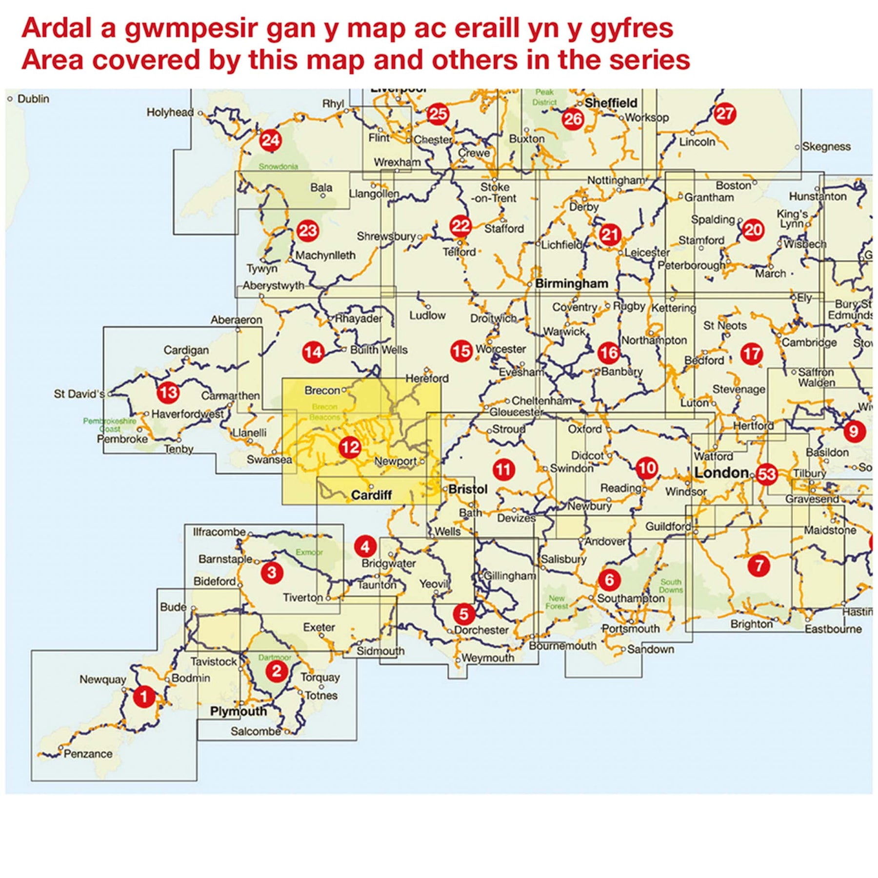
Where does the maps cover?
To see the coverage of Sustrans maps visit our Help with Maps page, showing the coverage of our long distance and regional maps.
Shipping
Orders received by 12pm will be dispatched on the same day Monday to Friday.
Orders placed over the weekend will be shipped Monday, excluding bank holidays.
Pricing
Free delivery for all UK orders over £100
Standard delivery £3.95 for orders up to 2kg
Standard delivery £5.50 for orders over 2kg
Next day delivery (RoyalMail Tracked 24) £11
Rest of the world
Delivery charges vary according to weight.
We are currently unable to ship to the United States and US outlying islands, Norway, Switzerland, Lichtenstein and Iceland.
Why don't we sell to the US?
Due to the recent suspension of the de minimis exemption, we’ve made the decision to temporarily pause all sales to the US. This change impacts how goods are imported and processed, making it challenging to continue offering our usual service to US customers.
We’re actively monitoring the situation and exploring solutions. Once we’re confident we can resume shipping reliably and cost-effectively, we’ll reopen US sales and notify our customers. Thank you for your patience and understanding.