Lôn Las Cymru South Map | Llanidloes to Chepstow/Cardiff Cycle Route (Route 8)
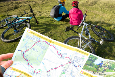
Sustrans' Lon Las Cymru South map is the official cycle route map for the southern half of the stunning Lon Las Cymru ride along National Route 8, featuring up to date mapping on waterproof paper.
Long-distance cycle map for Llanidloes to Chepstow or Cardiff bike route using NCN 8
The Lon Las Cymru South route connects Llanidloes in the heart of Wales to the attractive finishing points of Cardiff or Chepstow.
There are two route options - one via Hay-on-Wye to Abergavenny and Chepstow with a taste of the Black Mountains, and the second, following the largely traffic-free Taff Trail from Brecon to Cardiff via Merthyr Tydfil.
This full-colour map based on Ordnance Survey data shows clearly mapped cycle routes on traffic-free paths, quiet lanes and roads, with easy-to-read contours and route profiles. Also features detailed inset maps for the major towns and cities and tourist information.
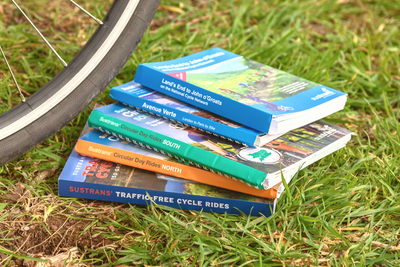
Shop all our long-distance cycle maps here.
Map details:
Publisher: Sustrans
ISBN: 978-1-914410-49-9
Published: 2023
Miles: 118 or 104
Size: 12.5 x 24cm folded, 87 x 47cm unfolded
Scale: 1:100,000
Paper: Printed on durable, waterproof paper and RPolyart Paper
National Route 8 between Llanidloes and Cardiff
National Route 42 between Glasbury and Chepstow
Where can I send route suggestions?
Please send all route suggestions to our Customer Service team at customer.services@sustrans.org.uk
Is there a PDF or GPX version to match the paper map?
You can find our selection of downloadable maps here.
We are working to expand our selection.
What is the paper quality like for Sustrans maps?
All of our maps are printed on waterproof and tear-resistant paper that can be recycled -perfect for all of your cycling adventures!
Where can I find the maps for Route 1?
On any Sustrans map page, click the blue square under "Routes covered" to be linked to all the related maps featuring that route number.
Where does the maps cover?
To see the coverage of Sustrans maps visit our Help with Maps page, showing the coverage of our long distance and regional maps.
Shipping
Orders received by 12pm will be dispatched on the same day Monday to Friday.
Orders placed over the weekend will be shipped Monday, excluding bank holidays.
Pricing
Free delivery for all UK orders over £100
Standard delivery £3.95 for orders up to 2kg
Standard delivery £5.50 for orders over 2kg
Next day delivery (RoyalMail Tracked 24) £11
Rest of the world
Delivery charges vary according to weight.
We are currently unable to ship to the United States and US outlying islands, Norway, Switzerland, Lichtenstein and Iceland.
Why don't we sell to the US?
Due to the recent suspension of the de minimis exemption, we’ve made the decision to temporarily pause all sales to the US. This change impacts how goods are imported and processed, making it challenging to continue offering our usual service to US customers.
We’re actively monitoring the situation and exploring solutions. Once we’re confident we can resume shipping reliably and cost-effectively, we’ll reopen US sales and notify our customers. Thank you for your patience and understanding.