County Durham & North Yorkshire Cycle Map (32)
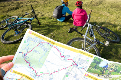
Sustrans' County Durham and North Yorkshire cycle map shows the National Cycle Network and local routes in this area. This cycle map includes the beautiful northernmost Yorkshire Dales National Park valleys of Swaledale and Wensleydale, which are linked by a section of the 130-mile circular Yorkshire Dales Cycleway.
Stage 1 of the 2014 Grand Depart of the Tour de France came this way over the challenging climbs of Buttertubs Pass and Grinton Moor.
About the County Durham and North Yorkshire cycle map
This cycle map covers sections of several routes running through County Durham and North Yorkshire, including:
- Sea to Sea (or C2C)
- Walney to Wear and Whitby (or W2W)
- North Sea Cycle Route
- Yorkshire Dales Cycleway.
There are also five individual day rides.
National Route 71 runs through Arkengarthdale linking the highest pub in Britain at Tan Hill and the very welcoming village of Reeth at the meeting point with Swaledale.
The Tan Hill Inn is also on the coast-to-coast Walney to Wear or Whitby (W2W) cycle route. From there the route heads across the Greta Valley to the bustling market town of Barnard Castle, where you can either head for Sunderland’s Wearmouth via Hamsterley Forest (with 33 miles of waymarked bike trails) and historic Durham city, or follow the River Tees to near Darlington and finally Whitby via the Esk Valley in the North York Moors National Park.
The Yorkshire Dales and the North York Moors are also linked by the continuation of National Route 71 from Reeth across the Vale of York via Northallerton to join the north-south running National Route 65 along the Cleveland and Hambleton Hills.
Just to the north of Weardale at the top of the map and deeper into the North Pennines AONB runs another, and perhaps the most famous UK coast-to-coast route, the original 136-mile Sea to Sea (C2C) cycle route.
Being on the East Coast Mainline, Darlington makes a great entry point to the region and connects via National Route 14 to coastal Hartlepool which lies above the mouth of the River Tees and at the southern end of the secretive Durham Heritage Coast. This route also connects with Durham itself, home to the Cathedral and Castle World Heritage Site.
National Routes 1 and 65 run through Tees Valley capital Middlesbrough and form part of the North Sea Cycle Route (EuroVelo 12).
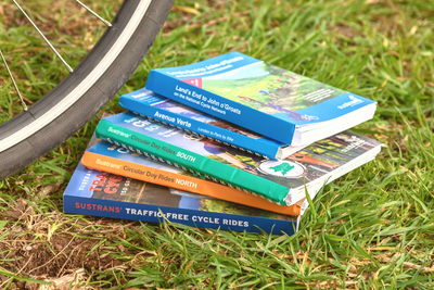
Shop our full range of regional cycle maps here.
Map details:
Publisher: Sustrans
ISBN: 9781910845813
Edition Published: May 2021
Scale: 1:110,000
Size: 10 x 15 cm folded, 60 x 80 cm unfolded
Printed on water and tear-resistant Polyart recyclable paper, category 2 HDPE.
Major cycle routes covered by this map:
National Route 1 from Middlesbrough to Seaham (Three Rivers and North Sea Cycle Route)
National Route 7 between Nenthead and Waskerley (C2C)
National Route 14 from Lanchester, through Durham, Hartlepool, Stockton-on-Tees and on to Darlington (Three Rivers)
National Route 65 from Middlesbrough down to Felixkirk
National Route 70 from Yorkshire Dales to Barnard Castle (Walney to Wear & Whitby), then on to Durham and Houghton-le-Spring
National Route 71 from Northallerton to Tan Hill
National Route 165: Barnard Castle to Great Ayton (Walney to Whitby)
National Route 656 through the North York Moors
National Route 657 from Upsail to Thirsk
National Route 715 from Whorlton to Bishop Auckland
Where can I send route suggestions?
Please send all route suggestions to our Customer Service team at customer.services@sustrans.org.uk
Is there a PDF or GPX version to match the paper map?
You can find our selection of downloadable maps here.
We are working to expand our selection.
What is the paper quality like for Sustrans maps?
All of our maps are printed on waterproof and tear-resistant paper that can be recycled -perfect for all of your cycling adventures!
Where can I find the maps for Route 1?
On any Sustrans map page, click the blue square under "Routes covered" to be linked to all the related maps featuring that route number.
Where does the maps cover?
To see the coverage of Sustrans maps visit our Help with Maps page, showing the coverage of our long distance and regional maps.
Shipping
Orders received by 12pm will be dispatched on the same day Monday to Friday.
Orders placed over the weekend will be shipped Monday, excluding bank holidays.
Pricing
Free delivery for all UK orders over £100
Standard delivery £3.95 for orders up to 2kg
Standard delivery £5.50 for orders over 2kg
Next day delivery (RoyalMail Tracked 24) £11
Rest of the world
Delivery charges vary according to weight.
We are currently unable to ship to the United States and US outlying islands, Norway, Switzerland, Lichtenstein and Iceland.
Why don't we sell to the US?
Due to the recent suspension of the de minimis exemption, we’ve made the decision to temporarily pause all sales to the US. This change impacts how goods are imported and processed, making it challenging to continue offering our usual service to US customers.
We’re actively monitoring the situation and exploring solutions. Once we’re confident we can resume shipping reliably and cost-effectively, we’ll reopen US sales and notify our customers. Thank you for your patience and understanding.