Belfast, Down & Armagh Cycle Map (49)
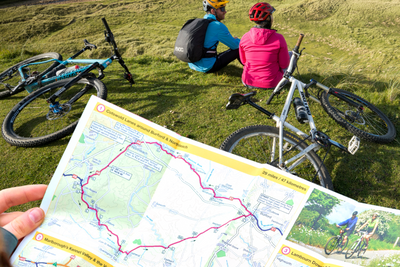
The Belfast, Down and Armagh cycle map shows the National Cycle Network and local routes in this area. It covers the south east of Northern Ireland including Belfast, Lisburn, Armagh, Newry, Strangford Lough, and Lough Neagh.
The National Cycle Network and cycle tracks in Belfast
This pocket-sized colour map shows clearly mapped on-road and traffic-free paths, easy to read contours, and detailed inset maps for the major towns and cities as well as recommended linking routes connecting the NCN with quiet roads. The map also features 5 day rides with directions and a description of the area, highlighting key cycle routes, local history and places of interest.
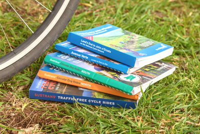
Shop our full range of regional cycle maps here.
Map details:
Publisher: Sustrans
ISBN: 978-1-914410-39-0
Edition Published: October 2021
Scale: 1:110,000 Main map
Size: 10 x 15 cm folded, 60 x 80 cm unfolded
Printed on water and tear-resistant Polyart recyclable paper, category 2 HDPE.
Major cycle routes covered by this map:
- National Route 9 connecting Belfast, Lisburn, Portadown, Scarva, Newry and Slieve Gullion, which includes the Lagan & Lough Cycleway and Newry Canal Towpath.
- National Route 91 from Armagh to Scarva or south of Portadown (route splits and part reclassified).
- National Route 93 from Whiteabbey to Belfast, and Newtownards to Bangor (the 2 sections connect via Route 99 between Belfast and Newtownards).
- National Route 94 around the southern half of Lough Neagh connecting Ardboe, Maghery, Portadown, Glenavy, Crumlin and the area west of Aldergrove, known as the Loughshore Trail (reclassified route).
- National Route 95 from Cookstown to Newmills, and Dungannon to Milltown.
- National Route 99 connecting Belfast, Comber, Newtownards, Portavogie, Portaferry, Downpatrick, and Newcastle. Includes Comber Greenway part of the Strangford Lough Cycle Trail.
- Regional Route 10 from Aghagallon to Route 91 south of Portadown.
- Regional Route 11 from Maghery to Milltown.
Where can I send route suggestions?
Please send all route suggestions to our Customer Service team at customer.services@sustrans.org.uk
Is there a PDF or GPX version to match the paper map?
You can find our selection of downloadable maps here.
We are working to expand our selection.
What is the paper quality like for Sustrans maps?
All of our maps are printed on waterproof and tear-resistant paper that can be recycled -perfect for all of your cycling adventures!
Where can I find the maps for Route 1?
On any Sustrans map page, click the blue square under "Routes covered" to be linked to all the related maps featuring that route number.
Where does the maps cover?
To see the coverage of Sustrans maps visit our Help with Maps page, showing the coverage of our long distance and regional maps.
Shipping
Orders received by 12pm will be dispatched on the same day Monday to Friday. Orders placed over the weekend will be shipped Monday*
Pricing
Free delivery for all UK orders over £100
Standard delivery £2 for orders of Sustrans maps (up to 2 maps)
Standard delivery £3.95 for orders up to 2kg
Standard delivery £5.50 for orders over 2kg
Next day delivery (courier) £11
Rest of the world
Delivery charges vary according to weight.
EU orders are subject to VAT charges which are included in the price seen at point of payment.
Delivery is via a specialised EU courier and can take up to 2 weeks.
*Excluding bank holidays